Multifamily Leasing Video: What Charlotte Communities Are Getting Wrong
Leasing pages sell units. Prospects lease buildings. Why amenity photos underperform and what a continuous walkthrough does to a tour-to-lease funnel.
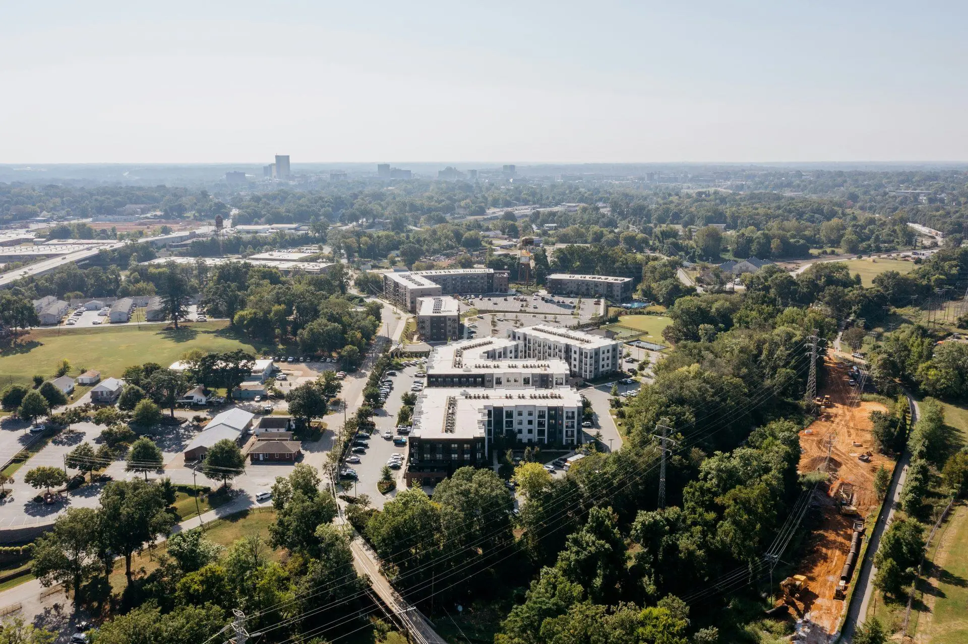
Almost every apartment community in Charlotte markets itself the same way, and the format has a hole in it.
You get a floor plan grid. A gallery of unit photos, usually a model unit, usually empty. A separate gallery of amenities: the pool, the gym, the clubroom, the dog park, each photographed alone. Somewhere there is a site map. All of it is accurate and none of it answers the question a prospect is actually holding, which is what it would be like to live there.
That gap is expensive, because multifamily is one of the few property categories where the marketing has to do the work of a tour before the tour happens.
The funnel problem specifically
Leasing is a two-stage funnel. Web traffic becomes a scheduled tour, and a tour becomes a signed lease. Those two stages fail for different reasons and most communities only invest in the first one.
Tour-to-lease conversion is usually decent, because once someone walks the property they can feel whether it works. The leak is upstream: prospects who bounce off the leasing page without ever booking, or who book three tours and only show up to one. They are triaging, and they triage on whichever listing gave them the most confidence about what they would actually be walking into.
A unit photo does not build that confidence. It shows a room that could be in any building in any city. What builds it is understanding the property as a place: where the gym is relative to your door, whether the pool is overlooked by four hundred windows, how far the parking is, whether the courtyard is a real courtyard or a gap between two buildings.
None of that is in a photo grid. It is inherently spatial, and spatial information needs continuous motion to communicate.
Why the walkthrough is the format
A continuous FPV flight through a community does something a photo set structurally cannot: it preserves the relationships between spaces.
The flight leaves the leasing office, moves down the corridor, through the amenity deck, past the pool, into a model unit, out onto the balcony, and back. No cuts. The prospect is not being told the gym is near the elevators, they are watching it be near the elevators. By the end they have a mental map of a building they have never entered.
That is the entire mechanism. It is also why the format works better here than in single-family listings, where a house is small enough that a photo set roughly conveys the layout. A 300-unit community with three amenity zones and two building phases is not comprehensible from stills, and everybody markets it with stills anyway.
Aerials do the complementary half. A community’s site plan, its position relative to a greenway or a light rail stop, the actual size of the courtyard, the parking situation: those are top-down and pull-back questions, and they get answered in about two seconds each from the air.
What a leasing content package should include
For a stabilized community, the useful stack is smaller than most agencies propose:
- One continuous property walkthrough. Leasing office through amenities into a model unit. 60 to 90 seconds. This is the hero asset and it belongs at the top of the leasing page.
- A short vertical cut. 20 to 30 seconds from the same flight, formatted for Instagram and TikTok, because a meaningful share of renters under 30 will encounter the community socially before they encounter the website.
- Exterior aerials. Site context, the greenway or transit proximity if it exists, the courtyard at true scale, and a top-down for the site plan.
- Amenity stills. Still worth having. They just should not be carrying the whole argument.
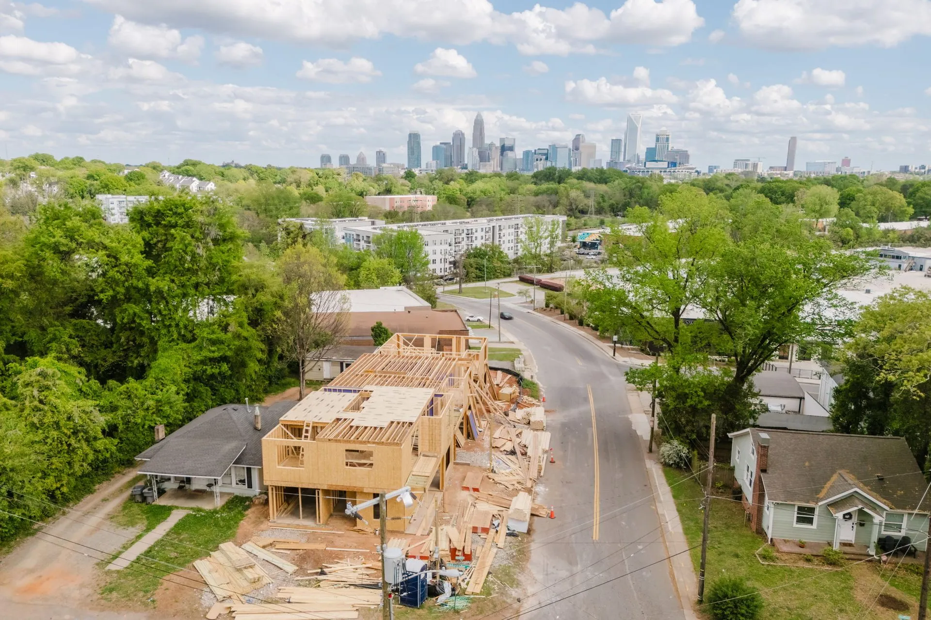
For a lease-up, add progress capture. A community leasing off a construction site has nothing to show and the strongest possible reason to show something, and monthly aerials from the same flight path give the leasing team content for the entire pre-opening window. That approach is covered in the construction progress post.
The things that make these shoots different
Multifamily has operational constraints that single-family does not, and they change the scoping.
Occupied buildings mean residents. Flying interior corridors and amenity spaces in a lived-in community requires notice, scheduling, and a small ducted aircraft. We fly a sub-3-inch cinewhoop for anything near people, never open props, and the shoot gets planned around low-traffic windows rather than whenever the leasing office is free.
Model units photograph better than they fly. A staged model is often the smallest space in the shoot, and small compartmentalized rooms are where FPV adds the least. Usually the right call is to fly the approach and the entry, then let stills carry the interior.
Amenity decks are the shot. Pool, clubroom, grill stations, coworking. That sequence is the most differentiated part of any community and the part most likely to be photographed as four unrelated pictures.
Airspace matters more than people expect. A large share of Charlotte multifamily sits inside CLT’s Class B shelf, and uptown and South End sites frequently need LAANC authorization before the aircraft leaves the ground. That is routine and it is filed in advance, but it is a real scheduling input rather than a formality.
Scoping and cost
Multifamily work is quoted per project, like all commercial. The published starting points: ground or aerial stills from $400, an FPV walkthrough from $600, and all three together from $1,000. Communities generally land above the floor, because square footage, the number of amenity zones, and the number of deliverable cuts all push scope up.
Two things move the number more than anything else: how many buildings or phases need coverage, and whether the deliverable is one hero video or a content set the leasing team will draw from for a year. The second version costs more once and much less per asset, which is usually the better trade for a community that posts weekly.
Full rates are on the pricing page, and the commercial page has the rest of the verticals.
The honest summary is that multifamily marketing has converged on a format that is easy to produce and weak at the one job it has. Everyone shows units. Almost nobody shows how the property works as a place, which is the thing a prospect is trying to figure out before deciding whether your community is worth an hour of their Saturday.
To scope a community, email contact@oneshotdronetours.com with the property, unit count, and which amenity spaces matter most.
Related journal posts
The Commercial Drone Media Playbook for Charlotte CRE
How Charlotte CRE brokers, developers, business owners, and hospitality operators use FPV and aerial drone media to lease space, close deals, and fill seats, across all four commercial verticals.

FPV Drone Tours for Charlotte Real Estate: The Full Playbook
A field guide to FPV drone tours for Charlotte listings: how we plan the route, direct the agent, pick the gear, and deliver the MLS and social cuts. Specifics, not sales copy.
Construction Progress Aerials: How Charlotte Developers Are Documenting Vertical Builds
How Charlotte developers use recurring drone captures to document vertical builds, frame registration, pre-sale marketing, LP updates, and the cadence that turns a year of work into 90 seconds.